2021- METODOLOGÍA PARA LA ORDENACIÓN TERRITORIAL DE CUENCAS HIDROGRÁFICAS SUJETAS A RIESGO DE INUNDACIÓN EN ZONAS URBANAS. APLICACIÓN EN TUXTLA GUTIÉRREZ (CHIAPAS, MÉXICO)
| Doctorando: |
Moisés Silva Cervantes |
| Nacionalidad: | México |
| Universidad: | Universidad Politécnica de Madrid |
| Facultad/Escuela: | E.T.S.I. Agronómica, Alimentaria y de Biosistemas |
| Año: | 2021 |
| Calificación: | Sobresaliente Cum Laude |
| Director: | Antonio Damián García Abril y Ana Hernando Gallego |
| Enlace: |
Abstract:
The constant pressure on the environment and natural resources is inherent to human progress, a fact that denotes the impact of man on the transformation of the natural landscape. Areas of natural forests are reduced, transformed into agricultural and/or livestock fields, housing developments, mining, roads, and other infrastructure. The last three decades have witnessed a rapid growth of the urban area of Tuxtla Gutiérrez, the capital of Chiapas, Mexico. Large areas of land that were once used for agricultural activities are now residential areas, and tree and shrub cover have decreased significantly. This thesis analyzes the temporal change in land cover in the Sabinal watershed, especially the increase in urban sprawl in the Metropolitan Zone of Tuxtla Gutiérrez, and how these changes have influenced vulnerability to hydrometeorological hazards. Actions are also proposed for the recovery and conservation of the watershed in accordance with orderly urban growth.
The general objective of the thesis is to develop a hydrological-forestry methodology for risk reduction in urban watersheds due to extreme rainfall, integrating diagnostic and prospective tools and considering the current conditions and the evolution of the territory, in physical-biological and socio-economic terms.
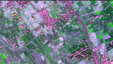
Firstly, in response to specific objective 1 "To analyze the changes in land cover and land use that have occurred over the last three decades in the Sabinal Basin", Landsat satellite images were processed for 1986, 2001, and 2014. Multiband mosaics of the Basin were created and subsequently, a supervised classification of each year was carried out, identifying and quantifying the changes in the coverages of 1) water, 2) woodland, 3) agricultural and pasture land, 4) bare soil and 5) residential and infrastructures.
The results show rapid growth of the urban area in the Sabinal Basin, especially in the municipality of Tuxtla Gutiérrez. From 1986 to 2014, while land for residential use increased annually by more than 3%, land for agricultural and pasture use decreased by around 1% per year, which in absolute terms is equivalent to a reduction of more than 5,000 hectares. Spaces that were previously used for agricultural activities are now residential and, except in ecological reserve areas, tree and shrub cover has decreased significantly.
Subsequently, in response to specific objective 2 "Simulate rainfall-runoff processes with a 2D model to analyze the effect of extreme rainfall and the risk of flooding in Tuxtla Gutiérrez", based on the identified land covers for the years 1986 and 2014, values of roughness and water infiltration in the soil were defined. In turn, based on historical rainfall values recorded in the Basin, precipitation values were estimated for three return periods (tr=1: 45 mm/h, tr=1.4: 60 mm/h and tr=10: 98 mm/h).
Roughness, infiltration, and precipitation values were used as input data in a 2D hydrological-hydraulic simulation model (with Iber software), using an unstructured triangle mesh generated from a LiDAR DTM with 5 m2 pixels and height variations in centimeters. As output variables, values of surface flow and maximum water height levels reached in the main channel of the Sabinal River were obtained and compared. A total of 6 simulation tests were applied, with the purpose of analyzing the effect of the three precipitation values as a function of two land cover conditions. In 1986 and 2014 we obtained a lower and higher degree of artificialization of the landscape, respectively. The tests were applied to a 60 km2 polygon located in the lower part of the Sabinal Basin, in the most densely populated urban area of Tuxtla Gutiérrez, where there have been recurrent problems of river overflows.
For the calibration, validation, and application of the model, we used the water level records of the Tuxtla Gutiérrez Hydrometeorological Alert System, developed by the National Water Commission. The model was validated by comparing the flows obtained from the simulation tests with those estimated using the Curve Number method. The Nash-Sutclif index was used as a validation criterion, obtaining an excellent level of accuracy.
From the results of the application of the model, it can be observed that the changes in land cover have resulted in higher flow levels in 2014 with respect to 1986, 33% more with rainfall of 45 mm/h and 15% more with rainfall of 98 mm/h. In turn, the simulated values of maximum water height are always higher in the 2014 coverage with respect to 1986 (67 -118 cm, 23-81 cm, and 7-44 cm more, with rainfall of 45, 60, and 98 mm/h, respectively). Because of the induced changes in soil cover in the Basin, the degree of soil impermeability increased significantly, the vegetation cover decreased and, consequently, evapotranspiration and water storage by it decreased. As a result, the surface runoff generated in 2014 is greater and, therefore, the risk of overflowing and flooding is higher.
Finally, specific objective 3 "to formulate a general planning scheme that serves as a basis for territorial planning work" addressed the problem of greater risks of overflowing and flooding in Tuxtla Gutiérrez. Using the 2014 coverages as a Base Scenario, a Scenario of change was developed for the year 2030, with the aim of achieving hydrological-forestal recovery and orderly urban growth in the territory of the Basin. To this end, we have relied on multi-criteria evaluation (MCA) and used GIS tools, in particular criteria for better land suitability, considering slope, soil type, and land use as the main factors.
It was estimated that by 2030, the population of Tuxtla Gutierrez and its surroundings will grow by approximately 27% with respect to the Base Scenario, the same proportion that residential land cover can grow without creating a major impact on the regional environmental balance. To achieve this Scenario, the agricultural land cover must be reduced by 17% and bare soil resulting from various erosion processes must be reclassified to recover 15% of tree cover. This would allow for orderly urban growth, i.e. directed towards areas that are environmentally and safely conducive to the population.
In conclusion, the methodological proposal presented in the thesis can serve as feedback to early warning systems for flood risks, to analyze hydrometeorological risks in small watersheds that lack monitoring infrastructure, and as a model for integrated land-use planning and management at the watershed level.
Resumen:
La presión constante sobre el medio ambiente y los recursos naturales es inherente al progreso humano, hecho que denota el impacto del hombre en la transformación del paisaje natural. Áreas de bosques naturales se reducen, son transformadas en campos agrícolas y/o ganaderos, urbanizaciones, extracciones mineras, carreteras y otras infraestructuras. En las tres últimas décadas se nota un rápido crecimiento del área urbana de Tuxtla Gutiérrez, capital de Chiapas, México. Extensas áreas de terreno que antes se utilizaban para actividades agropecuarias ahora son zonas residenciales y la cobertura arbórea y arbustiva ha disminuido notoriamente. En este trabajo se analiza el cambio temporal en las coberturas del suelo de la Cuenca del Sabinal, en especial el incremento de la mancha urbana en la Zona Metropolitana de Tuxtla Gutiérrez, y cómo dichos cambios han influido en la vulnerabilidad ante riesgos de origen hidrometeorológico. También se plantean acciones tendientes a la recuperación y conservación de la Cuenca en concordancia con el crecimiento urbano ordenado.
El objetivo general de la tesis es desarrollar una metodología hidrológico-forestal para la reducción de riesgos en cuencas urbanas por causa de precipitaciones extremas, integrando herramientas de diagnóstico y prospectiva, considerando las condiciones actuales y la evolución del territorio, en términos físico-biológicos y socioeconómicos.
En primer lugar, atendiendo al objetivo específico 1 “Analizar los cambios en las coberturas y usos del suelo, ocurridos en las tres últimas décadas en la Cuenca del Sabinal”, se procesaron imágenes de satélite Landsat correspondientes a los años 1986, 2001 y 2014. Se crearon mosaicos multibanda de la Cuenca y posteriormente se realizó una clasificación supervisada de cada año identificando y cuantificando los cambios en las coberturas de: 1) agua, 2) arbolado, 3) agropecuario y pastizales, 4) suelo desnudo y 5) residencial e infraestructuras.
Como resultados se advierte un rápido crecimiento de la mancha urbana en la Cuenca del Sabinal, sobre todo en el municipio de Tuxtla Gutiérrez. De 1986 a 2014, mientras que el suelo de uso residencial aumentó anualmente más de 3%, el de uso agropecuario y pastizales disminuyó alrededor de 1% por año, lo que en términos absolutos equivale a una reducción de más de 5 mil hectáreas. Espacios que antes se utilizaban para actividades agropecuarias ahora son residenciales y, excepto en áreas de reserva ecológica, la cobertura arbórea y arbustiva ha disminuido significativamente.
Posteriormente, atendiendo el objetivo específico 2 “Simular procesos de lluvia-escorrentía con un modelo 2D para analizar el efecto de precipitaciones extremas y el riesgo de inundación en Tuxtla Gutiérrez”, a partir de las coberturas del suelo identificadas de los años 1986 y 2014, se definieron valores de rugosidad e infiltración de agua en el suelo. A su vez, a partir de valores históricos de lluvia registrados en la Cuenca, se estimaron valores de precipitación correspondientes a tres períodos de retorno (tr=1: 45 mm/h, tr=1.4: 60 mm/h y tr=10: 98 mm/h).
Los valores de rugosidad, infiltración y precipitación se utilizaron como datos de entrada en un modelo de simulación hidrológico-hidráulica 2D (con el software Iber), utilizando una malla de triángulos no estructurada, generada con un MDT desarrollado a partir de datos LIDAR, con pixeles de 5 x 5 m y variaciones de altura en centímetros. Como variables de salida, se obtuvieron y compararon valores de caudal superficial y de niveles máximos de altura del agua alcanzados en el cauce principal del Río Sabinal. En total se aplicaron 6 ensayos de simulación, con el propósito de analizar el efecto de los tres valores de precipitación en función de dos condiciones de coberturas del suelo: la de 1986 y la de 2014, es decir, con menor y mayor grado de artificialización del paisaje, respectivamente. Los ensayos se aplicaron sobre un polígono de 60 km2 ubicado en la parte baja de la Cuenca del Sabinal, en la zona urbana con mayor densidad poblacional de Tuxtla Gutiérrez, donde se han presentado problemas recurrentes de desbordamientos del río.
Para la calibración, validación y aplicación del modelo, se recurrió a los registros de altura del agua en las estaciones de nivel del Sistema de Alerta Hidrometeorológica de Tuxtla Gutiérrez, desarrollado por la Comisión Nacional del Agua. El modelo fue validado comparando los caudales obtenidos mediante los ensayos de simulación con los estimados mediante el método del Número de Curva. Se utilizó como criterio de validación el índice de Nash-Sutclif, obteniendo un nivel de ajuste Excelente.
De los resultados de la aplicación del modelo, se advierte que los cambios en las coberturas del suelo, se han traducido en niveles de caudal mayores en 2014 con respecto a 1986, 33% más con las precipitaciones de 45mm/h y 15% más con las de 98 mm/h. A su vez, los valores simulados de máxima altura del agua siempre son mayores en la cobertura de 2014 con respecto a los de 1986 (67 -118 cm, 23-81 cm y 7-44 cm más, con las precipitaciones de 45, 60 y 98 mm/h, respectivamente). Como consecuencia de los cambios inducidos en las coberturas del suelo de la Cuenca, aumentó significativamente el grado de impermeabilización del suelo, disminuyó la cobertura vegetal y, por lo mismo, la evapotranspiración y el almacenamiento de agua por parte de ésta. De modo que en 2014 es mayor la escorrentía superficial que se genera y, por lo tanto, mayor el riesgo de desbordamiento e inundación.
En el objetivo específico 3 “formular un esquema de ordenamiento general que sirva de base a los trabajos de planeación territorial” se ha buscado atender la problemática de mayores riesgos de desbordamiento e inundación en Tuxtla Gutiérrez. Tomando como Escenario Base las coberturas de 2014, se desarrolló un Escenario de cambio al año 2030 con el cual se pretende lograr la recuperación hidrológico-forestal y el crecimiento urbano ordenado en el territorio de la Cuenca. Para ello, se utilizaron argumentos de evaluación multicriterio (EMC) aplicados sobre una plataforma de SIG, en particular criterios de mejor aptitud del suelo, considerando como principales factores la pendiente, el tipo de suelo y el uso del suelo.
Se estimó que para el año 2030, la población de Tuxtla Gutiérrez y sus alrededores crecerá aproximadamente 27% con respecto al Escenario Base, misma proporción que puede crecer la cobertura del suelo de tipo residencial sin crear mayor impacto al equilibrio ambiental regional. Para lograr dicho Escenario, hay que disminuir 17% la cobertura de uso agropecuario y reclasificar el suelo desnudo resultante de procesos erosivos diversos, con el fin de recuperar 15 % de la cobertura de arbolado. De esta manera se permitiría el crecimiento urbano ordenado, es decir, dirigido hacia zonas propicias en términos ambientales y de seguridad para la población.
En conclusión, la propuesta metodológica expuesta en la tesis puede servir para retroalimentar a los sistemas de alerta temprana para riesgos de inundación, para analizar riesgos hidrometeorológicos en pequeñas cuencas que carecen de infraestructura para el monitoreo y como modelo para la planeación y ordenamiento territorial integral a nivel de cuenca hidrográfica.


